Wednesday, March 13, 2024 5:45 AM
Prepared by Bob Weisman, SCSU Meteorologist and Professor Emeritus
Wild Spring Fling of Temperatures
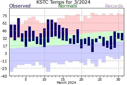
Spring is the season during which Minnesota temperatures can do almost anything. The averages climb quickly in March from near 30 at the start to the upper 40's at the end of the month, but the record temperatures show the true potential of temperature swings. Our 70-degree high on March 3 was the earliest 70-degree high in St. Cloud records, but 80's become possible by the end of the month. On the other hand, March highs can be as cold as the plus single digits or teens and lows can still be in the -20s and even a -30 or two in the first half of March. The extreme lows are only possible when we have a snow cover, which has been missing for most of this cold season. The snow reflects the bulk of the incoming sun's warmth back into space during the day, so temperatures begin the evening cooler than they would have been.
Ignoring the extreme mildness of the past winter, there still have been wild temperature swings from near record warmth to near average temperatures on a weekly basis this month and earlier in the season. However, the change from late February into March has been wild daily swings in temperature. Temperatures have frequently climbed more than 25 degrees from the morning low to the afternoon high (see 30-day graph of St. Cloud temperatures from MesoWest). But, Monday was the wildest ride (see NWS March St. Cloud high-low temperature table). The morning low was only 24 degrees, but the afternoon temperature climbed 44 degrees to the record 68-degree high. Our 70-degree high on March 3 was a 36-degree climb from the morning low. Even Sunday, which didn't get nearly as warm as Monday, still had a 36-degree jump from a morning low in the teens to a high over 50 degrees.
Large Daily Temperature Swings Caused by Dry Air
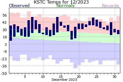
This is different than what we frequently saw in late December and early January; until our mid-January cold interlude, much of the mildness was caused by very warm low temperatures but with smaller increases to the high temperature. The difference between now and then? How dry we have been.
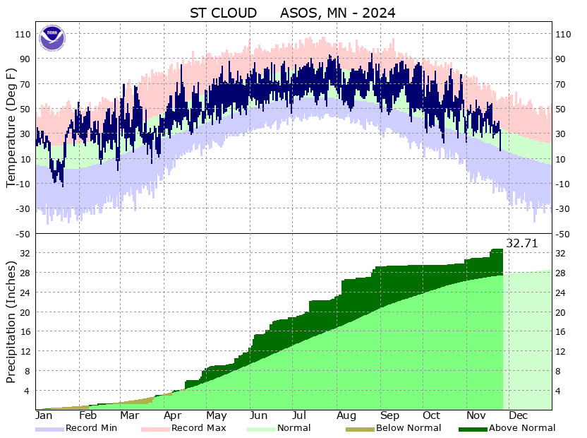
In December, St. Cloud had a record 3.35 inches of rain. Even when we weren't raining, there were lingering low clouds as the low level moisture hung around. However, the rain has become much less frequent from the second half of January on (see how infrequently the brown column moves upward). Water vapor is a greenhouse gas. It acts the same way as carbon dioxide; it absorbs some of the incoming solar radiation during the day, and keeps some of the overnight heat loss by absorbing the outgoing radiation and reradiating it back to the ground. So, high temperatures aren't quite as high and low temperatures are much milder than they would be otherwise. The daily temperature range gets even smaller if we are cloudy all day with low clouds being the most effective at keeping high temperatures down and low temperatures up.
When we are so dry that there isn't much moisture even in the ground, more of the sun's heat gets through to the ground during the day, but much more of the outgoing earth radiation goes out to space at night, so we see bigger swings of temperature, especially when the warm fronts and cold fronts come through without a lot of clouds. Note that water vapor is more abundant (1-4 percent of the atmosphere) than any of the greenhouse gases being produced by human activity (note that carbon dioxide concentrations are listed in parts per million, so they are less abundant. No, this isn't proof that global warming is a hoax, because carbon dioxide is still an efficient greenhouse gas by radiation properties, and it has been low during cold periods on earth and high during warmer periods.
Back to the point, we will be prone to large daily temperature swings when we are sunny until we get sufficient rain to moisten the ground, and more importantly, get the surface vegetation green.
Some Substantial Rain Overnight, But Even Further Away Than Had Been Forecast
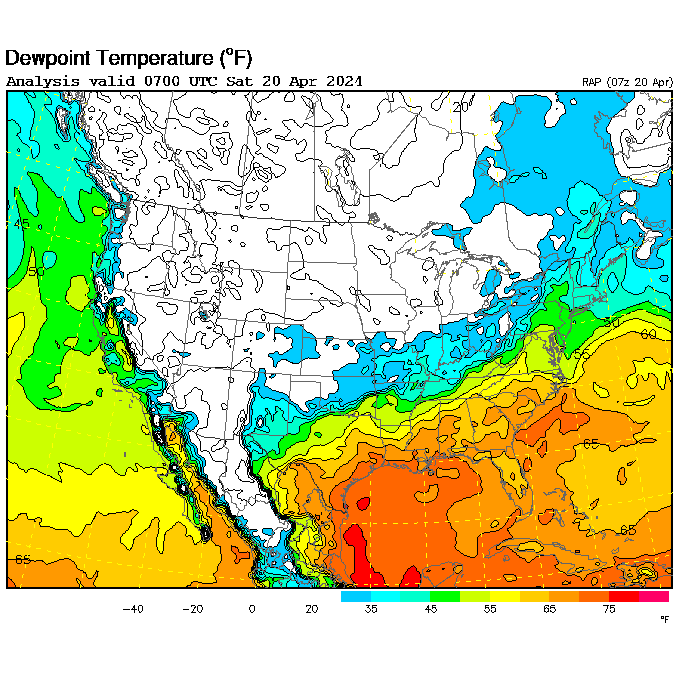
This morning, we are seeing one more example of why it's so dry. The warm air we've had the past three days (highs over 60 degrees; see 30-day graph of St. Cloud temperatures from MesoWest) has been very dry with dew points no higher than the lower 30's (see UCAR hourly dew point chart). And, the storm system going to our south (see Mid-tropospheric water vapor loop from Colorado State satellite slider) got enough moisture into Missouri and Iowa to produce thunderstorms (those oval "blobs" on the Shortwave Albedo satellite loop from Colorado State satellite slider). The stronger thunderstorms have sucked up the bulk of the moisture, so any showers trying to move from northern Iowa into southern Minnesota have weakened (set number of frames to at least 96 on the College of Du Page north central US radar loop). And, even those radar echoes are having trouble getting rain to the ground before evaporating (very few red dots in southern Minnesota on the NWS Aviation Weather Center METAR map). So, even southern Minnesota is likely to see less rain than earlier forecast from this system. In central Minnesota, the showers will be few and far between (I've knocked the chance down to 1 in 10).
Only Lake Breeze Keeping Us from Another Run Into the Upper 50's
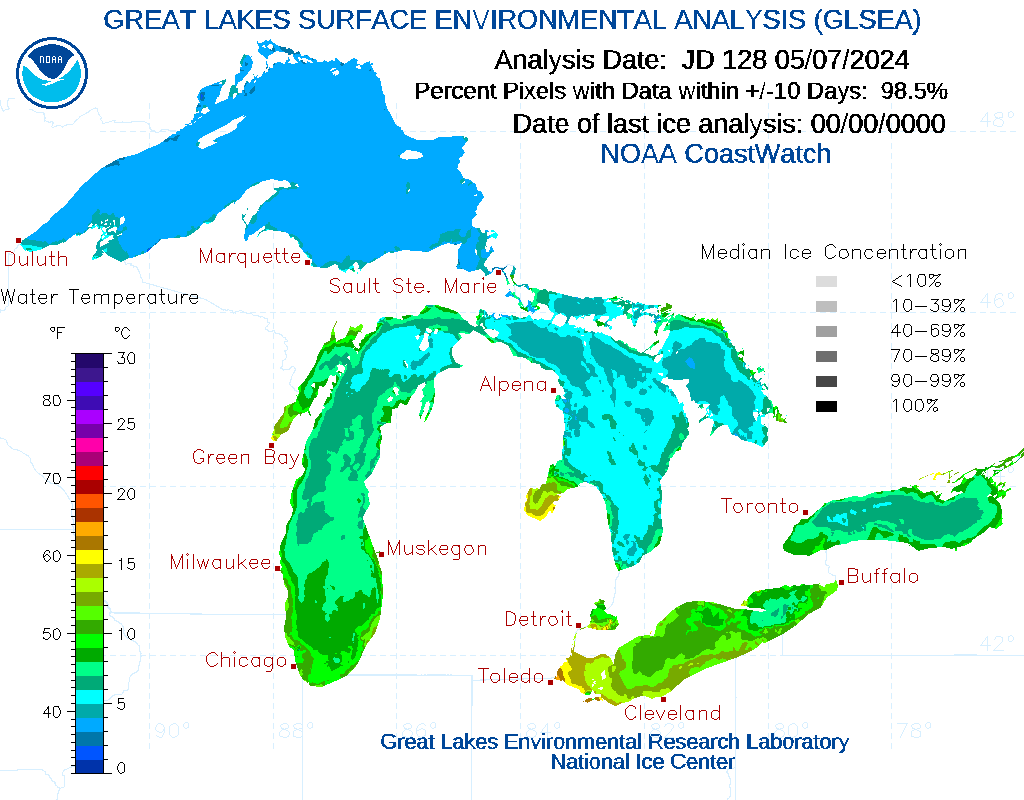
That would mean we have a better chance of seeing some sun during the later two-thirds of the day. We will have northeast winds move in. Along the Lake Superior north shore, temperatures climbed to the 50's and even 60's yesterday (see 4 PM Wednesday NWS WPC North America zoom-in map). However, that was because the winds were from the west, so the trip down the hill towards the lake provided extra warming. Today's air flow will have a long path over Lake Superior. While the Great Lakes have had an incredibly low amount of ice this past winter, most of Lake Superior has water temperatures in the middle 30's to near 40. That's cooler than the new air mass, so it will be harder to get a high well up in the 50's today. So, our highs around 50 degrees, typical of early to mid-April, will be a good 10-15 degrees cooler than the past 3 days. Tomorrow, we will have similar highs.
Colder Air on Track for Saturday, With Fewer Chances for Snow Coating
On Saturday, the much stronger cold front in the Yukon (see 4 PM Wednesday NWS WPC North America zoom-in map) will push through during the early morning hours. The air now appears dry enough that even snow flurries will be few and far between, so I've taken the chance for a snow coating out of the forecast. There will be a lot of clouds on Saturday and Sunday, so some snow flakes are possible, but they won't amount to anything in central Minnesota. Even the Boundary Waters and the Canadian border will only see light precipitation with merely a coating to an inch of snow possible.
However, we will still have wind and colder temperatures. Readings may begin Saturday in the low to middle 40's, but will fall back into the upper 30's by afternoon. Highs on Sunday will only be in the lower 30's at best. With the strong northwest winds blowing at 15-30 MPH with gusts over 35 MPH from midday Saturday through Sunday morning, wind chills will fall back through the 20's Saturday afternoon, drop to between 5 and 15 Saturday night and Sunday morning, then only recover to the teens in the afternoon. All of that wind and overnight clouds will keep our lows from dropping too much, so lows will be in the 30's the next two nights and only drop to the 20's on Saturday night. Winds will be lighter on Sunday night, so upper teens may be possible. Monday will be relatively cold, with highs in the middle to upper 30's, but lighter winds and more sunshine will make it feel better than Saturday afternoon or Sunday.
Temperatures will rebound a bit next Tuesday. The second half of next week is more uncertain with a series of nearby storms at least raising the possibility of some precipitation. These storms will be working with very dry air at the start, so any precipitation would be light until late week or the weekend.
Detailed St. Cloud, MN, and Vicinity Forecast
Confidence Level: "The Bugs Are Waiting for Me to Mow the Lawn"
Thursday 3/14/2024: Mostly cloudy in the morning. Becoming partly sunny midday and afternoon, breezy, and cooler. High: between 47 and 52. Winds: NE 8-15 MPH. Chance of measurable rainfall: 10%.
Thursday Night: Partly to mostly cloudy, diminishing wind late, and cooler. A slight chance of a stray snowflake. Low: between 32 and 37. Winds: NE 5-15 MPH, becoming NW 5 MPH in the early morning hours. Chance of measurable snowfall: 10%.
Friday 3/15/2024: Sunshine through high and middle clouds, breezy, but still like early April. High: between 47 and 52. Winds: NW 8-15 MPH in the morning, SW 10-20 MPH in the afternoon. Chance of measurable rainfall: 10%.
Friday Night: Cloudy, breezy, and still mild. A slight chance for a sprinkle or snow flurry in the early morning hours. Low: between 32 and 37. Winds: SW 8-15 MPH, becoming NW 10-25 MPH in the early morning hours. Chance of measurable precipitation: 20%.
Saturday 3/16/2024: Lots of clouds with perhaps a few sunny breaks, blustery, and turning colder. Perhaps a stray snow flake or two. High: between 40 and 45 in the morning, falling into the 30's during the afternoon. Winds: NW 15-30 MPH with gusts over 35 MPH. Wind chill: in the 20's. Chance of measurable snowfall: 20%.
Confidence Level: "Extra Bugs Will Come From Every Home on the Block to Hover Around My Head"
Saturday Night: Mostly cloudy with a chance of a stray snow flake or two. Windy, and colder. Low: between 25 and 30. Winds: NW 15-25 MPH with higher gusts evening, 10-20 MPH with gusts over 25 MPH late at night. Wind chill in the teens. Chance of measurable snowfall: 20%.
Sunday 3/17/2024: Like the early March we haven't had yet. Some morning sun, then a lot of afternoon clouds with a stray snow flake or two, blustery, and colder. High: between 28 and 34. Winds: NW 15-25 MPH with gusts over 30 MPH. Wind chill between 5 and 15 in the morning, in the teens in the afternoon. Chance of measurable snowfall: 20%.
Sunday Night: Lots of clouds with a few clear breaks, not as windy, and cool. Low: between 20 and 25. Winds: NW 10-20 MPH with higher gusts evening, N 5-15 MPH late at night. Wind chill between 5 and 15. Chance of measurable snowfall: 10%.
Monday 3/18/2024: Sunshine through high clouds, not nearly as windy, and a bit milder. High: between 32 and 37. Winds: NW 5-15 MPH in the morning, SW 5-15 MPH in the afternoon. Wind chill between 5 and 15 during the early morning, in the 20's from late morning through the afternoon. Chance of measurable snowfall: 10%.
Confidence Level: "Enough Bugs Will Fly into My Mouth to Throw Off My Diet"
Extended: Milder on Tuesday?? Changeable weather next week?? Chance of precipitation late in the week??
Forecast Confidence (10 - "The Rabbits Will Thump Even Though I Fed Them"; 0 - "The Rabbits Will Offer To Groom My Bald Spot"): 8 Wednesday, 7 Wednesday night and Thursday, 5 Thursday night and Friday, 4 Friday night through Saturday, 3 Saturday night and Sunday.
Yesterday's High: 62°F; Overnight Low (through 3 AM Thursday): 47°F
St. Cloud Airport 24-Hour Melted Precipitation (through 3 AM Thursday): None; SCSU 24-Hour Precipitation (through 3 AM Thursday): None
Next Update: Friday, March 15, 2024 6 AM